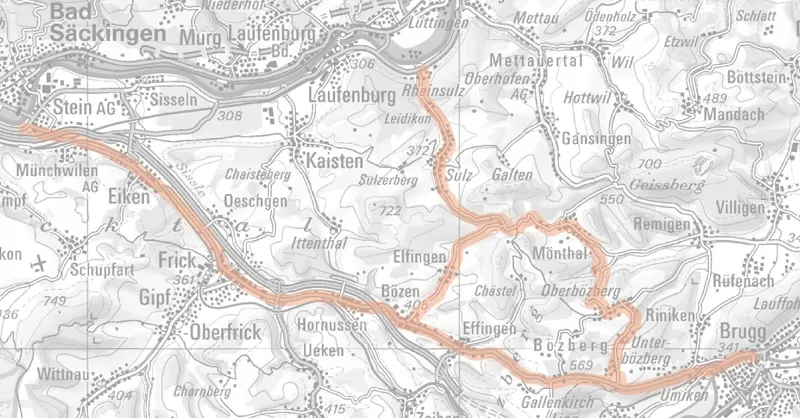
Nagra’s height measurements begin at the Bözberg
As part of the Sectoral Plan for Deep Geological Repositories, Nagra is investigating Jura Ost as a potential siting region for a repository. Height measurements provide information on the evolution of the landscape with time and are part of the field investigation programme. These so-called precision levelling measurements are used to determine the height difference between two points. A special feature of this work is that, as early as 1930, the Federal Office of Topography (today: swisstopo) carried out the first measurements on the Bözberg. Such long-term measurement series make it possible to determine changes in height over several decades.
To ensure the quality of the data and information, swisstopo is supporting the project and is responsible for evaluating the data. The measurements are linked to ongoing field work of swisstopo and they are intended to complement one another; this why the investigations are being carried out now. The Aargau Cantonal Surveying Office will provide technical support to Nagra in planning the measurement points and quality control.
Most of the work is carried out along public roads, with appropriate traffic regulations in place. The measurements are being made along three routes (see map below) and are expected to last until the end of April.
